
History and scientific significance
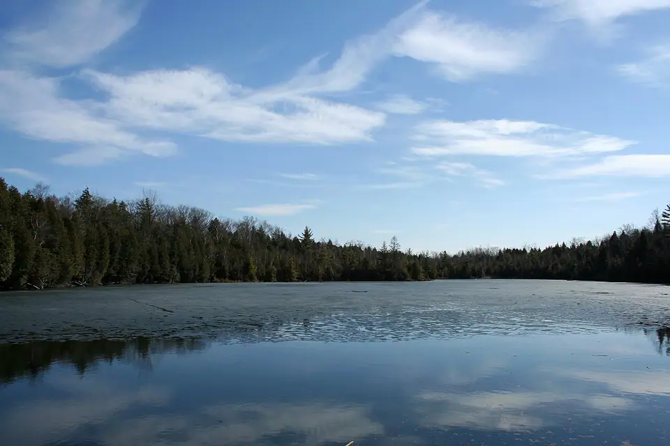
The land that became Crawford Lake Conservation Area was established as a park in 1969. Their house remained until it burned down, leaving only a cement front porch. A scientific study in 1971 determined the lake was meromictic, meaning its upper and lower water layers rarely mix. This unique condition preserves annual layers of sediment at the lake bottom, similar to tree rings, which scientists have used for archaeological and geochemical studies.
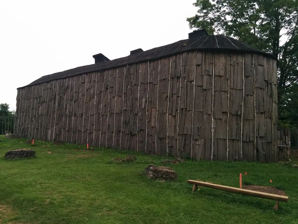
Pollen analysis of these sediments revealed corn pollen from the 13th to 15th centuries, leading to the discovery of a pre-contact Indigenous village site just south of the lake. A search of the area found a grindstone, which would have been used in such a village. Archaeological excavations between 1973 and 1987 uncovered the foundations of 11 longhouses and over 10,000 artifacts from day-to-day life. The village is thought to have been inhabited by either the Wendat (Huron) or Attawandaron (Neutral) peoples in the 15th century. Based on this research, three longhouses have been reconstructed on their original footprints, although the original village did not have a palisade.
In July 2023, Crawford Lake was selected by the Anthropocene Working Group as the proposed global reference point, or golden spike, for the beginning of the Anthropocene epoch. This decision was based on a clear plutonium signal found in sediment layers dated to 1950, originating from nuclear bomb testing. The lake beat 11 other candidate sites from around the world. This formal geological proposal was later rejected in March 2024 by geological bodies, but the lake remains a significant site for tracking environmental change through its sediment record.
The park was established in 1969, but the land's history extends far beyond that. The Crawford family, for whom the lake is named, once lived on the property and later donated the land to the conservation authority. The family also operated a cedar tree farm on the opposite side of the lake, adding to the area's historical narrative. Photographs of the original house and family members exist, providing a visual record of this earlier period.

The meromictic lake and natural features
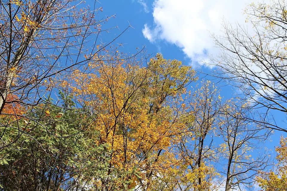
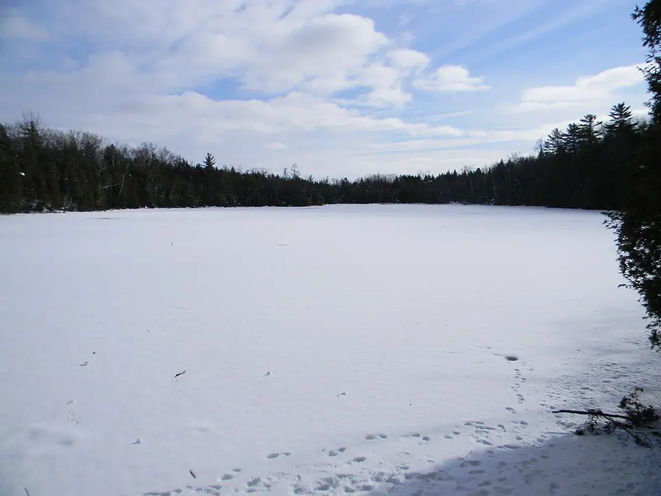
Crawford Lake is a rare meromictic lake with a maximum depth of about 23 metres, or 75 feet. Its monimolimnion, or deepest layer, unusually contains dissolved oxygen, unlike the anoxic conditions typical of such lakes. The lake's sediment cores have allowed scientists to reconstruct pollution and environmental history over approximately 150 years. The conservation area encompasses 232 hectares of land on the Niagara Escarpment. The landscape includes forested areas, the Nassagaweya Canyon, and connections to the wider Bruce Trail network.
The lake's unique properties make it a prime location for scientific study. Its meromictic nature means the upper and lower water layers rarely mix, preserving annual sediment layers. These layers, similar to tree rings, contain a record of environmental changes. Scientific analysis of sediment cores has allowed for the reconstruction of pollution history and trends over approximately 150 years. This research provides valuable data on air pollution sources and environmental shifts in the region.
 Play video: Explore Ontario's HIDDEN GEM Crawford Lake Conservation Area!🌿🌊
Trail network and outdoor activities
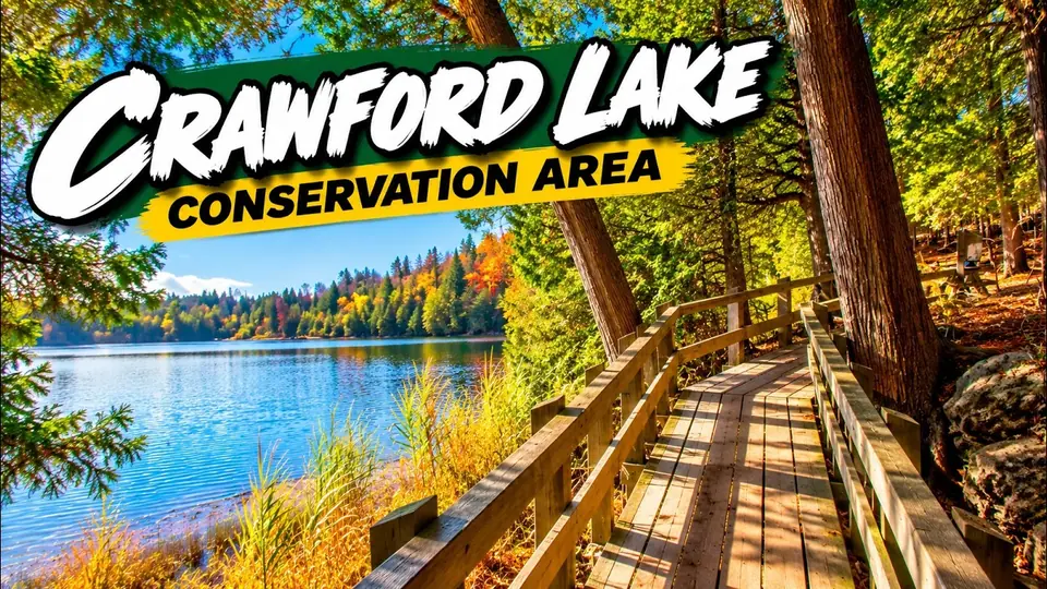
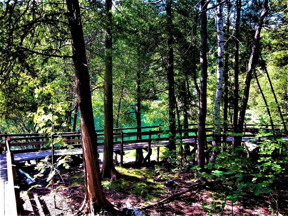
The park features 19 kilometres of trails for hiking, cross-country skiing, and snowshoeing. A boardwalk trail circles Crawford Lake, designed to protect the sensitive shoreline environment while providing access. This boardwalk was reconstructed with government funding and reopened in September 2024 after a closure for upgrades, making it stroller accessible. The trail is decorated with various sculptures and artistic benches. The park's trail network includes several distinct routes of varying lengths and difficulties, with connections to the Bruce Trail. One specific route, the Nassagaweya Canyon Trail, links Crawford Lake to nearby Rattlesnake Point Conservation Area. Swimming and fishing are not permitted in Crawford Lake to protect its sensitive ecosystem, which is crucial for ongoing scientific research. The park offers a wide range of educational programs and tours for schools and organizations. Activities vary by season, with hiking in warmer months and snowshoeing and cross-country skiing available in winter. The Pine Ridge Trail is designated for cross-country skiing.
- The Crawford Lake Trail is a 1.4-kilometre loop on a boardwalk around the lake.
- The Woodland Trail is a 1.5-kilometre easy loop through the forest that connects to several other trails.
- The Escarpment Trail is a 2.4-kilometre moderate loop with a lookout over Nassagaweya Canyon, often with sightings of turkey vultures.
- The Pine Ridge Trail is a 3.6-kilometre moderate loop also used for cross-country skiing in winter.
- The Nassagaweya Trail is a one-way route of approximately 4.7 kilometres connecting to Rattlesnake Point, with a round trip of about 9.4 kilometres.
- The Hide and Seek Trail features chain saw sculptures of species at risk.
The trail network within the conservation area is extensive and varied. It offers 19 kilometres of trails suitable for hiking, cross country skiing, and snowshoeing. These trails connect to the broader Bruce Trail network, allowing for longer excursions. One specific trail connects Crawford Lake to the nearby Rattlesnake Point Conservation Area, which is located 2.2 kilometres away. This connection provides hikers with opportunities to explore a wider area.

The reconstructed longhouse village
The reconstructed 15th-century Iroquoian village is a central heritage feature open seasonally and for special events. The three longhouses are furnished with items representative of the period, including fireplaces, fur-lined bunk beds, and various tools. One longhouse, the Deer Clan Longhouse, is used for seasonal exhibits exploring contemporary Indigenous art and culture, displaying artifacts recovered from past digs. The Three Sisters art exhibit, featuring stories by Tuscarora artist Raymond R. Skye, is displayed in this longhouse on weekends and holidays until December 2026. Interpretive programs on Iroquoian life and culture are offered, including simulated digs and fire-starting demonstrations. The village site also includes the Three Sisters Garden and Mashkiki Gitigan, meaning Medicine Garden. These gardens were developed in partnership with Ojibiikaan Indigenous Cultural Network and Miinikaan Innovation and Design to educate about Indigenous agriculture, foodways, and healing. The reconstructed village is based on extensive archaeological work conducted between 1973 and 1987. The reconstructions include three longhouses built on their original footprints, although the original village did not have a palisade. The site offers interpretive programs to educate visitors about Iroquoian life and culture.
Admission, fees, and facilities
Rates depend on age and the method of purchase. As of a 2024 source, purchasing a ticket online in advance cost $10.50 for adults aged 15 to 64 and $7.25 for children aged 5 to 14. Paying at the gate upon arrival cost $12 for adults and $8.75 for children. Reservations are not required but are recommended, especially on busy weekends and during fall colour season, and can provide a discount on gate fees. A Conservation Halton membership may offer better value for repeat visits to this and other parks in the network like Hilton Falls or Mount Nemo. An outdoor picnic area is available. Gathering place facilities are provided. The boardwalk around the lake is stroller accessible following its reconstruction.
| Category | Detail |
|---|---|
| Size | 232 hectares (approximately 94 hectares per another source) |
| Trail Network | 19 km total |
| Lake Depth | Approx. 23 metres (75 feet) |
| Established | 1969 |
| Archaeological Excavations | 1973 to 1987 |
| Longhouses Reconstructed | 3 |
| Boardwalk Length | 1 km (part of the 1.4 km Crawford Lake Trail loop) |
| Distance to Rattlesnake Point | 2.2 km (straight-line to the nearby conservation area) |
Admission to Crawford Lake Conservation Area requires a fee, with rates that vary by age and season. The park features a visitors centre that includes gathering spaces, a gift shop, theatres, lunchrooms, and various exhibits and displays. An outdoor picnic area is also available for visitors to use. The park is owned and operated by Conservation Halton, which manages this 232 hectare site. It is categorized as a regional environmentally sensitive area and part of the Niagara Escarpment world biosphere reserve.

Location and transportation
Crawford Lake Conservation Area is located at 3115 Conservation Road in Milton, Ontario, with the postal code L9T 2X3. The park is situated near the community of Campbellville on top of the Niagara Escarpment. Milton GO Station is the western terminus of the Milton line and offers parking for commuters and a bus loop serving GO and Milton Transit buses. Local transit is provided by Milton Transit. All of Milton Transit's regular routes, except for route 1 and 21, start and end at Milton GO Station. GO Transit bus routes 21, 21A, 21F, 22, 27A, and 27F also serve Milton GO Station. Driving from Toronto takes approximately one hour via Highway 401. The park is also about a one-hour drive from Toronto. The nearest GO Transit rail station is Milton GO Station, situated approximately 8.7 kilometres away. Local public transit is provided by Milton Transit, which operates several bus routes in the area. The park is situated about one hour's drive from Toronto, making it accessible for day trips from the city.
The area and nearby places
The park is within the Town of Milton in Halton Region, part of the Greater Toronto Area. Milton is situated on the Niagara Escarpment and was the fastest growing municipality in Canada between 2001 and 2011. The town's population was 132,979 in 2021. The conservation area is directly connected by trail to Rattlesnake Point Conservation Area, another park listed 2.2 kilometres away. The Nassagaweya Canyon Trail provides a hiking link between the two parks. The broader region includes several other conservation areas and natural sites, such as Rattlesnake Point Conservation Area.
The conservation area is part of the Niagara Escarpment, a UNESCO World Biosphere Reserve. It is also designated as a provincial Area of Natural and Scientific Interest. The nearby Rattlesnake Point Conservation Area is a notable neighbouring park located just 2.2 kilometres away. The region offers a variety of other conservation areas and natural sites for visitors to explore.

Nearby
- 1Rattlesnake Point Conservation AreaPark or outdoor area2.2 km
Straight-line distances computed from OpenStreetMap coordinates.
Questions
Do you have to pay to get into Crawford Lake?
Yes, Crawford Lake Conservation Area charges an admission fee. Rates vary by age, with separate prices for adults and children. Purchasing a ticket online in advance typically costs less than paying at the gate. Admission fees apply and vary by age. Reservations are recommended, especially on busy days, and can secure a discounted rate compared to gate fees.
What's so special about Crawford Lake?
Crawford Lake is a rare meromictic lake, meaning its water layers do not fully mix. This preserves annual sediment layers at the bottom that act as a historical record. Scientists have used these layers to find evidence of 15th-century Indigenous agriculture and to study pollution history. The lake was also proposed as the global marker for the beginning of the Anthropocene geological epoch due to plutonium deposits from 1950. The surrounding conservation area contains a reconstructed Iroquoian village based on archaeological discoveries from the site.
Can you swim in Crawford Lake?
No, swimming is not allowed in Crawford Lake. Fishing is also prohibited. The lake is part of a Regionally Environmentally Sensitive Area, a Provincial Area of Natural and Scientific Interest, and the Niagara Escarpment UNESCO World Biosphere Reserve. The lake is protected due to its unique meromictic conditions and scientific value. The park encourages walking on the boardwalk to view the lake.
How long is the walk around Crawford Lake?
The main walk around Crawford Lake is on a boardwalk that forms a loop. The Crawford Lake Trail is 1.4 kilometres in total length. The boardwalk itself is approximately one kilometre long. This trail is an easy, family-friendly walk that provides access to views of the lake and interpretive signage about its natural and scientific significance.
What can visitors see at the longhouse village?
Visitors to the longhouse village can see three reconstructed 15th-century longhouses built on their original archaeological footprints. The longhouses contain furnishings like fireplaces and bunk beds, and displays of artifacts and contemporary Indigenous art. The Deer Clan Longhouse hosts seasonal exhibits. The site includes the Three Sisters Garden and a Medicine Garden for learning about Indigenous agriculture. Interpretive programs, such as simulated archaeological digs, are offered to educate about Iroquoian life and culture.
Sources
- Crawford Lake Conservation Area, Wikipedia.
- Crawford Lake, Conservation Halton, Conservation Halton.
- This spot in Ontario has a boardwalk that wraps around a rare lake, Toronto.com.
- More than $1.6M invested in Milton's Crawford Lake boardwalk makeover, Inside Halton.
- Crawford Lake, Ontario’s Conservation Areas, ontarioconservationareas.ca.
- Crawford Lake Conservation Area, Hamilton Halton Brant, theheartofontario.com.